QLD Road Closures – Live Status and Detours
Queensland’s vast road network faces regular disruptions from tropical weather systems, infrastructure maintenance, and emergency incidents. Access to real-time closure information remains critical for safe journey planning across the state’s diverse regions.
The Department of Transport and Main Roads maintains official records of all state-controlled road closures through its digital platforms. Current data indicates significant flooding impacts in Far North Queensland, with multiple developmental roads impassable and strategic highways operating under restrictions.
Understanding how to verify closure status before departure helps motorists avoid hazardous conditions and lengthy detours. Official sources provide updated assessments as conditions evolve.
What Are the Current Road Closures in Queensland?
- Peninsula Developmental Road is severed between Laura and Weipa, blocking Cape York access.
- Burke Developmental Road remains closed at multiple river crossings due to sustained flood levels.
- Kennedy Developmental Road operates under four-wheel-drive restrictions only.
- Bruce Highway experiences localized closures for infrastructure upgrades near Gordonvale.
- Gregory Developmental Road is impassable between Einasleigh and Gulf Development Road.
- Real-time camera feeds and push notifications available through official TMR channels.
| Road / Highway | Status | Cause | Expected Reopen | Detour |
|---|---|---|---|---|
| Peninsula Developmental Road (Laura to Coen) | Closed | Heavy rain and river flooding | Unknown | No alternate route |
| Peninsula Developmental Road (Coen to Weipa) | Closed | Heavy rain and river flooding | Unknown | No alternate route |
| Burke Developmental Road (Trimbles Crossing) | Closed | Long-term flooding | Unknown | Not advised |
| Burke Developmental Road (Lynd River crossing) | Closed | Long-term flooding | Unknown | Not advised |
| Gregory Developmental Road (Einasleigh to Gulf) | Closed | Heavy rain flooding | Unknown | Check QLDTraffic |
| Kennedy Developmental Road | 4WD Only | River flooding | Pending assessment | Sealed alternatives |
| Bruce Highway On Ramp Southbound (Gordonvale) | Closed | Planned roadworks | Pending completion | Local diversions |
How Do I Check QLD Road Closures?
Digital Platforms and Real-Time Maps
The QLDTraffic website provides state-wide information on incidents, hazards, closures, roadworks, and rest areas. Users can access live traffic imagery through web cameras relaying near real-time conditions before commencing travel.
Mobile Applications and Phone Services
The official QLDTraffic app is available on Apple platforms and Android devices. The application allows users to save favourite routes and receive personalized push notifications regarding traffic issues and reopening updates.
For immediate voice assistance, motorists may call 13 19 40 to speak directly with the Department of Transport and Main Roads regarding current conditions and vehicle registration requirements.
Enable location services within the QLDTraffic app to receive automated alerts when approaching closed or restricted roadways. The system integrates with Transport and Main Roads data feeds to provide warnings specific to your selected journey routes.
Road Closures in Major QLD Areas Like Brisbane
Far North Queensland Flooding Impacts
As of late March 2026, Far North Queensland districts report extensive closures across developmental roads. The Peninsula Developmental Road remains severed at multiple points between Laura, Coen, and Weipa due to heavy rain and river flooding.
Burke Developmental Road experiences closures at Trimbles Crossing and Lynd River crossing. Gregory Developmental Road is impassable between Einasleigh and Gulf Development Road. Kennedy Developmental Road remains restricted to four-wheel-drive vehicles only.
South-East Queensland Infrastructure Works
Brisbane and surrounding areas face localized disruptions from planned maintenance. The Bruce Highway On Ramp Southbound at Gordonvale is closed specifically for roadworks rather than weather events. Motorists should consult council-specific dashboards for metropolitan Brisbane closure data.
Causes of QLD Road Closures and Reopening Updates
Weather-Related Disruptions
Tropical weather systems generate the majority of unplanned closures across Queensland’s northern regions. Heavy rainfall causes river levels to rise across the Cape York Peninsula and Gulf Country, rendering developmental roads impassable for extended periods. Saturated ground conditions prevent heavy vehicle access even when water levels begin receding.
Planned Maintenance and Construction
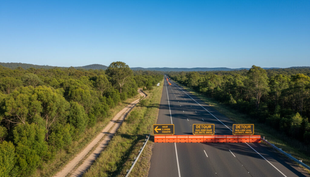
Strategic infrastructure upgrades require scheduled closures of major highways including sections of the Bruce Highway. These events differ from weather closures as they follow predetermined timelines with established completion dates and signed detour routes.
Transport and Main Roads advises that motorists should never enter flooded roadways. Official guidance emphasizes that floodwaters may conceal washed-out roadbeds, debris, or electrical hazards. The majority of flood-related vehicle rescues occur on roads marked as closed or restricted.
Motorists encountering unreported hazards or damage should contact the Department of Transport and Main Roads immediately via 13 19 40. For Cook Shire Council managed roads, reports should be directed to 131 940 or through the council’s official channels.
When Will Closed QLD Roads Reopen?
- : Peninsula Developmental Road closes between Laura and Coen due to heavy rain and river flooding. Status remains closed with no reopening date established.
- : Peninsula Developmental Road section between Coen and Weipa closes simultaneously due to identical weather conditions.
- : Burke Developmental Road closes at Trimbles Crossing and Lynd River crossing due to long-term flooding impacts.
- : Gregory Developmental Road closes between Einasleigh and Gulf Development Road following heavy rainfall.
- : Kennedy Developmental Road is restricted to four-wheel-drive vehicles only as river flooding affects surface conditions.
- : Bruce Highway On Ramp Southbound at Gordonvale closes for planned roadworks with reopening pending construction completion.
What Information Is Confirmed vs. Pending?
| Established Facts | Information That Remains Unclear |
|---|---|
| Specific road segments closed in Far North Queensland including Peninsula, Burke, Gregory, and Kennedy Developmental Roads. | Exact reopening dates for flood-affected roads pending hydrological assessments and engineering inspections. |
| Bruce Highway closure at Gordonvale is due to planned roadworks, not weather. | Duration of continued rainfall impacts on road surfaces in remote regions. |
| QLDTraffic provides official real-time updates via website, app, and phone line 13 19 40. | Temporary restrictions on weight limits for commercial vehicles once roads reopen. |
| Cook Shire Council roads require contact through specific council channels separate from TMR. | Comprehensive list of alternative routes for all closed developmental roads. |
Why Do Queensland Roads Close Frequently?
Queensland’s geographic diversity exposes its road network to distinct seasonal challenges. Northern regions experience tropical cyclones and monsoonal troughs that generate rapid river rises across the Cape York Peninsula. These weather patterns can isolate communities for weeks when developmental roads traverse flood plains and low-lying catchments.
The state’s extensive remote road infrastructure requires constant maintenance to remain trafficable. Unsealed surfaces on developmental roads deteriorate rapidly under sustained wet conditions, forcing closures even after floodwaters subside to prevent irreversible damage to the roadbed.
Strategic planning for vehicle coverage and roadside assistance becomes essential when traversing regions prone to sudden isolation.
Who Provides Official Road Closure Information?
“Check traffic conditions and plan your journey before driving through the QLDTraffic platform, which provides state-wide information on road conditions including incidents, hazards, closures and restrictions.”
— Department of Transport and Main Roads
“For Cook Shire Council managed roads, contact the Department of Transport and Main Roads at 131 940 or visit the official traffic website.”
— Cook Shire Council Road Conditions Advisory
Additional municipal resources include the Bundaberg Regional Council and Western Downs Regional Council disaster dashboards, which provide localized updates for council-managed roads outside state-controlled networks.
How Can Motorists Prepare for Road Closures?
Preparation requires verifying conditions through official channels immediately before departure, particularly during wet seasons. Motorists should download offline maps, carry emergency supplies when traveling remote routes, and establish communication protocols with destination contacts. Understanding insurance coverage and registration status ensures compliance when utilizing alternate routes through different jurisdictions.
Common Questions About QLD Road Closures
How do I report a road closure in Queensland?
Contact the Department of Transport and Main Roads immediately by calling 13 19 40. For council-managed roads, contact the relevant local authority directly through their disaster dashboard or emergency number.
Are Brisbane CBD roads currently closed?
Current data indicates no widespread Brisbane CBD closures, though localized disruptions occur for planned roadworks. Check the QLDTraffic map for real-time metropolitan updates.
What mobile app shows QLD road closures?
The official QLDTraffic app provides real-time closure data, live camera feeds, and push notifications for both Android and Apple devices.
Why is the Peninsula Developmental Road closed?
The road is closed due to heavy rain and river flooding affecting multiple sections between Laura, Coen, and Weipa in Far North Queensland.
How long do flood-related road closures typically last?
Duration depends on rainfall intensity, soil saturation, and infrastructure damage. Long-term flooding can extend closures for weeks until engineering assessments confirm safety.
Where can I find information on council-managed roads?
Consult specific council disaster dashboards such as those maintained by Cook Shire, Bundaberg Regional Council, or Western Downs Regional Council for roads outside state control.
More related posts
 Jackson Rathbone: Ethnicity, Age, Wig & Net Worth
 Telstra Mobile Plans: Compare Prices, Data & Coverage
 Mark Butler: Minister for Health & Aged Care, Biography
 Shiva God: Role, Names, Beliefs, and Key Facts
 Banana Smoothie Recipe: 3-Ingredient, Diabetic-Friendly & More
 Light Brown Hair: Shades, Comparisons & Dye Guide
 The Hardware Club – Seed VC for Hardware Founders
 Tax Calculator 2025 Ireland: Compare PwC, Deloitte Tools
